map of all travel guide in Austria

Webcams in Austria

Elevation: 2,205 m
Panorama view from the Unterberg in Mayrhofen through the Zillertal.
18 °C
8 minutes ago
Elevation: 241 m
View from the Curatorship for Traffic Safety in the south of Vienna over the Austrian capital.
10 °C
18 minutes ago
Elevation: 974 m
Your view at Feilmoos / Alpbachtal valley.
19 °C
1 hour ago
Elevation: 2,296 m
This webcam is located in the Wetterstein mountains and shows the Meilerhütte.
12 °C
15 minutes ago
Elevation: 1,337 m
View of Hochficht top station
18 °C
1 hour ago
Elevation: 687 m
Located at lift café Heisn you can view direction Reither Kogel.
20 °C
55 minutes ago
Elevation: 1,828 m
You can see the view from the top station of DIAS-Bahn in Kappl.
15 °C
56 minutes ago
Elevation: 1,845 m
View from Grießenkareck in Wagrain.
°C
55 minutes ago
Elevation: 1,759 m
Webcam located at Loosbühelalm near Grossarl.
°C
temporarily unavailable
Elevation: 1,871 m
View from Wiedersbergerhorn in Alpbachtal valley, Tyrol..
10 °C
58 minutes ago
Elevation: 1,175 m
The webcam is located at the Teichalm base station and offers a view of Teichamsee.
13 °C
7 minutes ago
Elevation: 1,665 m
This webcam shows you the view of the mountain hut Walde at Hahnenkamm mountain
20 °C
59 minutes ago
Elevation: 584 m
Here you can spot the view from the railway station of the Tyrolean capital Innsbruck towards the city.
°C
9 minutes ago
Elevation: 308 m
The webcam offers a view of the St Stephan's Church in Horn in Lower Austria.
°C
19 minutes ago
Elevation: 1,850 m
View from the top station on Kreuzkogel over the surrounding mountains.
°C
1 hour ago
Elevation: 2,007 m
°C
1 hour ago
Elevation: 1,119 m
Enjoy the view over Scharnitz
18 °C
23 minutes ago
Elevation: 687 m
Located at lift café Heisn you can view direction Reither Kogel.
20 °C
55 minutes ago
Elevation: 1,214 m
You can see the top station of the Popolo 2 chairlift in Eben/Pongau.
19 °C
1 hour ago
Elevation: 1,791 m
View at the Jib Park
°C
8 minutes ago
Elevation: 1,598 m
Have a look at Galtür, a Tyrolean village with 800 inhabitants well known as a tourist destination.
°C
1 hour ago
Elevation: 1,335 m
At the Highwaay 69 in the north of Lavamünd, there is this webcam which is directed to the popular Koglereck, where visitors can enjoy a...
°C
temporarily unavailable
Elevation: 426 m
Your view from Mirabellgarten and castle Hohensalzburg in Salzburg, Austria.
°C
1 hour ago
Travel Deals & Tips
Advertisement

Dream destination for active holiday makers

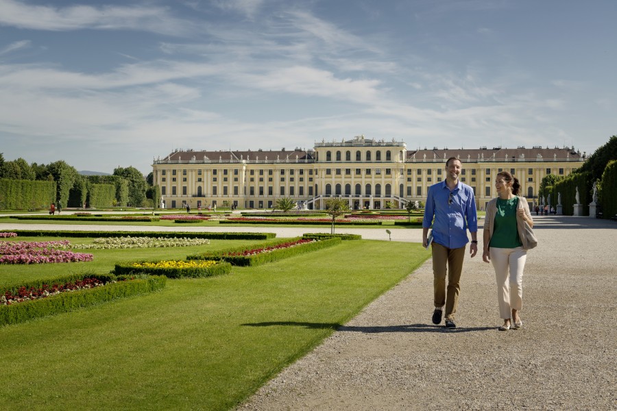
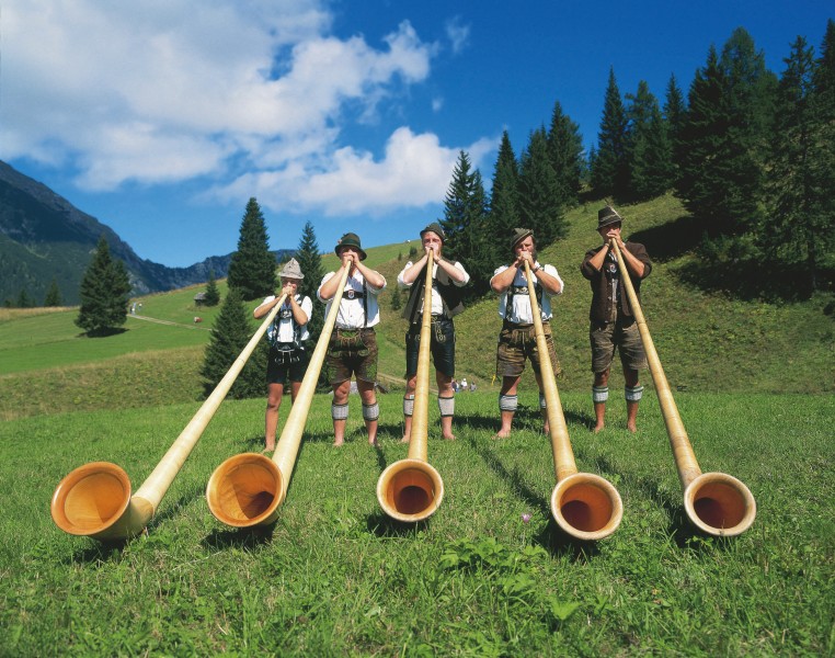
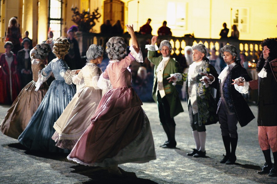
The Alpine Republic Austria is a truly manifold holiday destination. Besides cosmopolitan cities like Vienna, Salzburg, Graz or Innsbruck, which have a rich cultural life, the picturesque landscapes and idyllic mountain pastures of the Alps guarantee ample opportunity to enjoy the nature.


Austria is a dream destination for active holiday makers. The beautiful scenery is ideal for extensive walks and cycle tours, while numerous lakes invite for a swim. Amusement parks, toboggan runs and rope climbing gardens promise additional action for young and old. The Alpine region also has much to offer for culture enthusiasts: The country is marked by historical buildings, diverse museums, galleries, theaters and music stages.


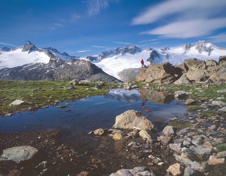
Located in the heart of Europe, Austria borders on Germany, the Czech Republic, Slovakia, Hungary, Slovenia, Italy, Switzerland and Liechtenstein. Nine federal states form this multifaceted country. Upper and Lower Austria north-east, as well as the Burgenland south-east are the flatter regions. Styria, Carinthia, Salzburg, Tyrol and Vorarlberg are dominated by the Alps. Over 950 three-thousand-meter mountains can be counted in Austria – and above all of them emerges the 3.798 meter high Großglockner.

    Travel Deals & Tips
    Advertisement
    Advertisement
    Advertisement
    Advertisement
    Travel Deals & Tips
    Advertisement
    Login with Google+
    • Share your personal insider tip and create new entries
    • Explore fantastic outdoor destinations when and where you want
    • Find your dream destination or discover the world on the interactive map